Thursday, September 06, 2007

Old Map of Przemysl

[Click to enlarge]

This map dates from the 17th century. Small note: the object in the lower left hand corner of the city that is marked "28" is the Alte Synagogue, destroyed by Nazis c. 1943.

This map comes to me courtesy of Gal V in Israel. Gal is researching his wife's family roots in Przemysl, names: Adolf and Zalc/Salz. Their daughter will visit Przemysl with her school this fall.

Labels:

Sunday, January 07, 2007

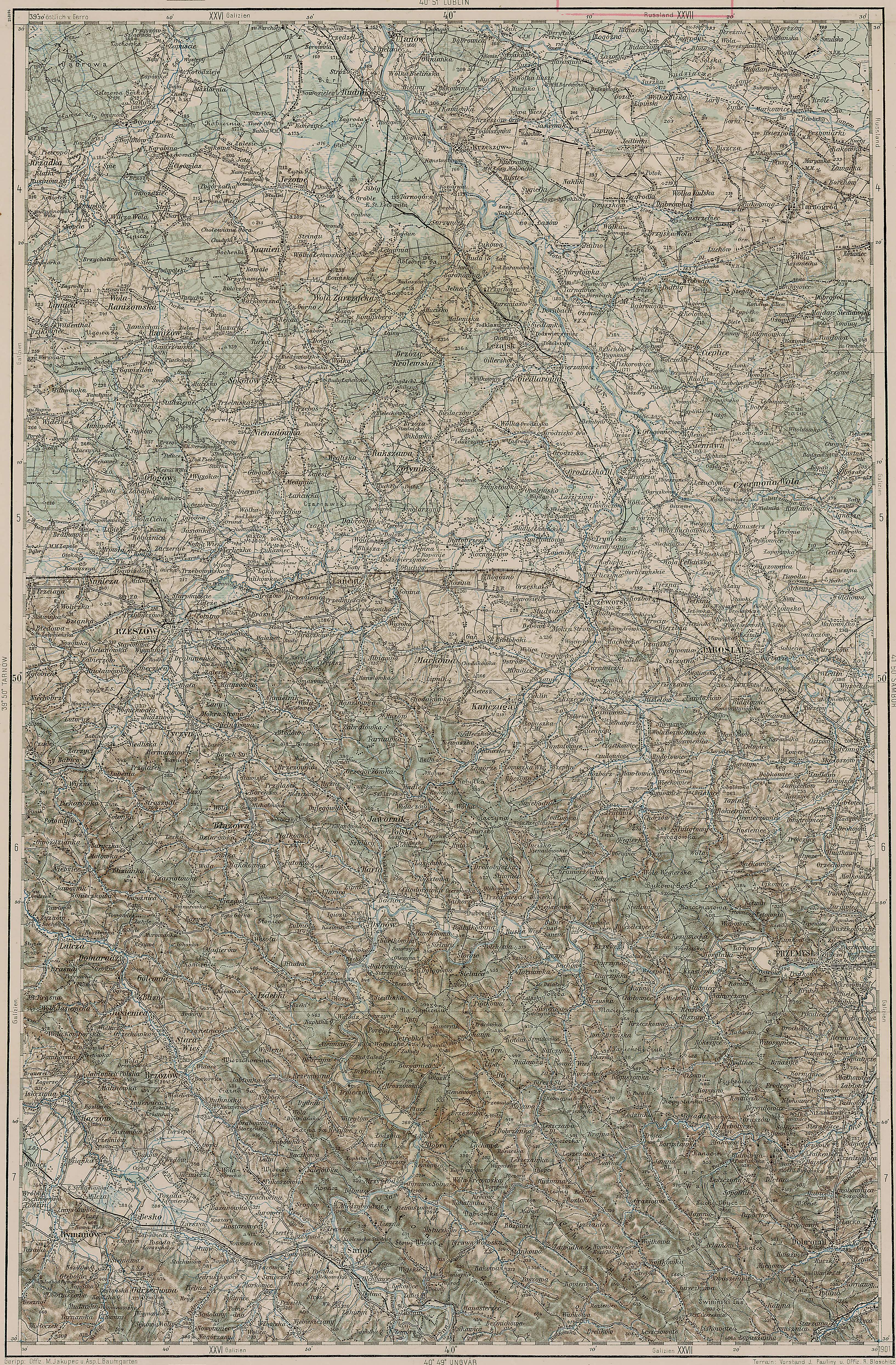
Extremely detailed maps - c. 1910

Here is a link to a series of extremely detailed topographic military maps of Austria-Hungary made in 1910. They show every town, every road and every hill, regardless of size. Click on the sector you want to look at, but be careful - they are 3.5Mb each - they take a while to display!

Here is the Przemysl area map

Labels:

Wednesday, November 15, 2006

The Przemysl Ghetto


From the Yizkor book, here is a map showing the progression of the Nazi ghetto in Przemysl.

(Click to enlarge.)

Labels: ,

Monday, November 13, 2006

A Map of Modern Przemysl

Click to enlarge this map (It is very detailed).

Click here for pre-Shoah map.

Labels:

Friday, November 10, 2006

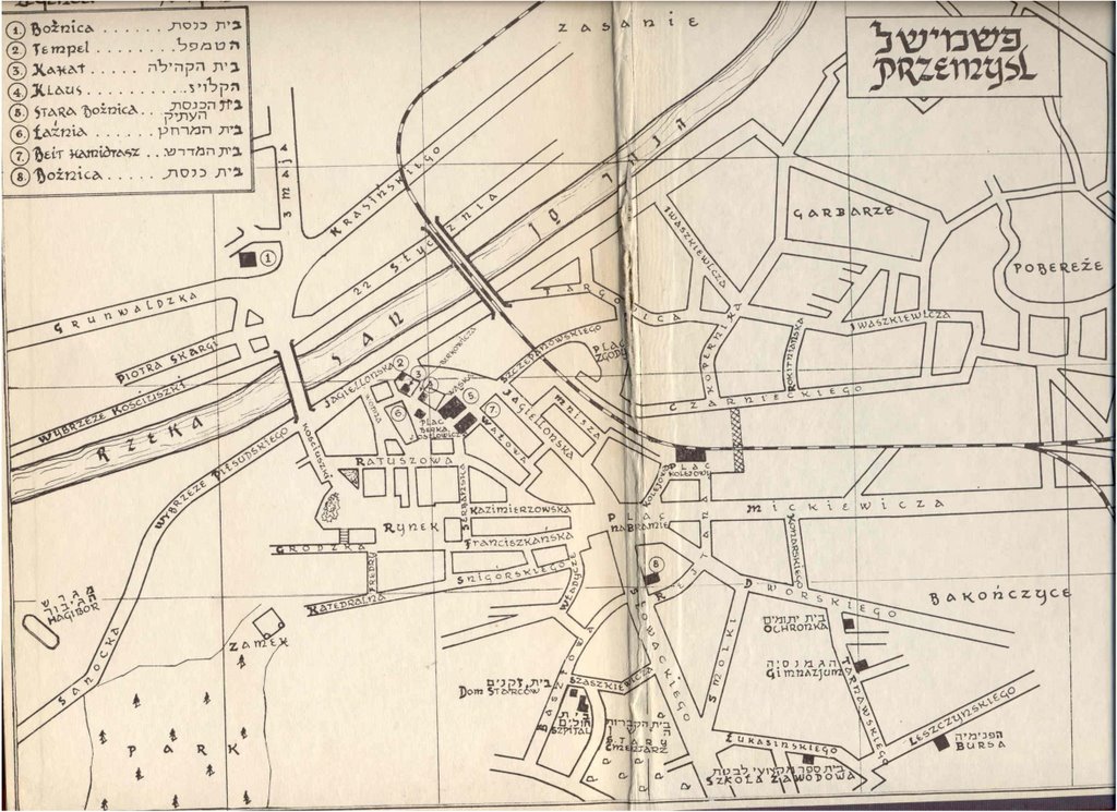
An map of Jewish Przemysl

This map is from the inside cover of the Przemysl Yizkor book.

The index on the upper left:
1. Zasanie Synagogue
2. The Temple
3. Kahat – Community congregation
4. Klaus – ???
5. The Old Synagogue
6. Bath house
7. House of Study
8. Scheinbach Synagogue (now the town library)

Only 1 and 8 are still standing. I will post photos of the magnificent Temple and Old Synagogue in a future post. The new Jewish cemetery is located at the bottom of the map on Slowackiego.

My great-grandparents Marcus and Channa lived across from the rail station on Czarnieckiego. Later, this was the part of town that the Nazis made into the Jewish ghetto.

If you click on the map, it will expand.

Shabbat Shalom

Labels: